Drone technology will improve the accuracy of storm intensity forecasts.
By Ramon Lopez
Original Air Date: May 29, 2026
Host: Hurricane season begins this Monday, June 1. Ramon Lopez brings us an update—and the latest on drones and storms.
Ramon Lopez: Hurricane season begins June 1. Sarasota County emergency officials are encouraging residents to review their emergency plans, update disaster supply kits and stay connected. This, as dangerous storm surge remains one of the greatest hurricane hazards.
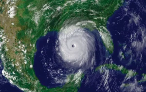
Photo via NOAA
But all the national weather services are forecasting a below-normal 2026 hurricane season.
The National Weather Service is predicting a total of eight to 14 named storms. Of those, three to six are forecast to become hurricanes. But only one to three are expected to be major Category Three, Four or Five hurricanes. That means winds of 111 mph or higher. Colorado State University researchers and the AccuWeather group’s numbers are about the same.
This compares to an average season with 14 named storms with seven hurricanes, including three major ones. The 2025 Atlantic hurricane season ended with 13 named storms, five hurricanes and four major hurricanes. Fortunately, none threatened or directly impacted Florida.
NOAA is now integrating advanced weather prediction modeling and hurricane tracking technologies to deliver real-time forecasts and warnings. They include: AI-based weather models, next-generation satellite data and drones.
For the first time, data collected by small unmanned aircraft systems will be integrated into NOAA’s operational hurricane forecast model. This will improve hurricane intensity forecast accuracy by as much as 10%.
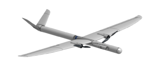
Black Swift Technologies S0 UAS. | Illustration via Black Swift Technologies
P-3 Orion Hurricane Hunters will drop the new small drones developed by Black Swift Technologies to gather critical data, such as pressure, temperature, humidity and wind from just above the ocean’s surface.
Scientists say the region plays a critical role in storm development and strengthening. But that’s a notoriously difficult environment for aircraft to safely operate in.
NOAA Hurricane Hunter electronics technician Todd Richards explains.
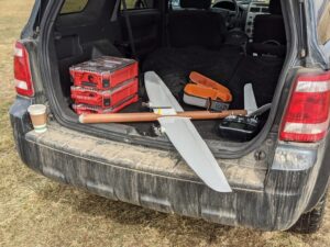
Black Swift Technologies So UAS. | Photo via Black Swift Technologies
Todd Richards: The UAS is basically a dropsonde that we can control. So, when we drop a wind sonde out of the aircraft, we have no control of it afterwards.
It’s falling at a stable rate, usually, and we’re collecting that data and sending it back. With the UAS, with the Black Swift, we can control where it goes, but it’s collecting the exact same data; it’s just, we can get a higher density look in certain parts of the storm that the sondes just kind-of blow through.
The idea with the drones is to get down, low-level, surface to 2,000 feet, in that mixing layer, because we don’t have a lot of information about what’s happening in that mixing layer.
RL: This is Ramon Lopez for WSLR News.
WSLR News aims to keep the local community informed with our 1/2 hour local news show, quarterly newspaper and social media feeds. The local news broadcast airs on Wednesdays and Fridays at 6pm.
 It's drive week!
Your gift keeps 96.5 on the air. Be one of the people who make it happen.
Donate Now
It's drive week!
Your gift keeps 96.5 on the air. Be one of the people who make it happen.
Donate Now